yahoo Press
Satellite spies an erupting volcano | Space photo of the day for March 13, 2026
Images
1 / 10
2 / 10

3 / 10

4 / 10

5 / 10

6 / 10
7 / 10

8 / 10

9 / 10

10 / 10
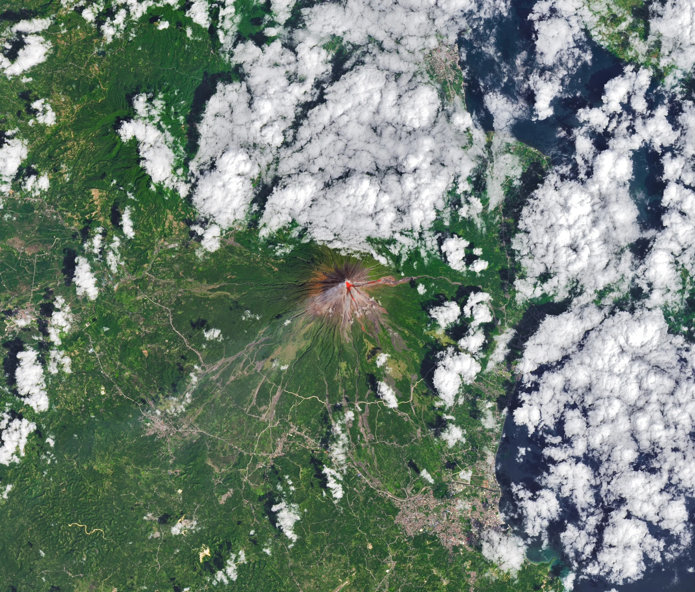
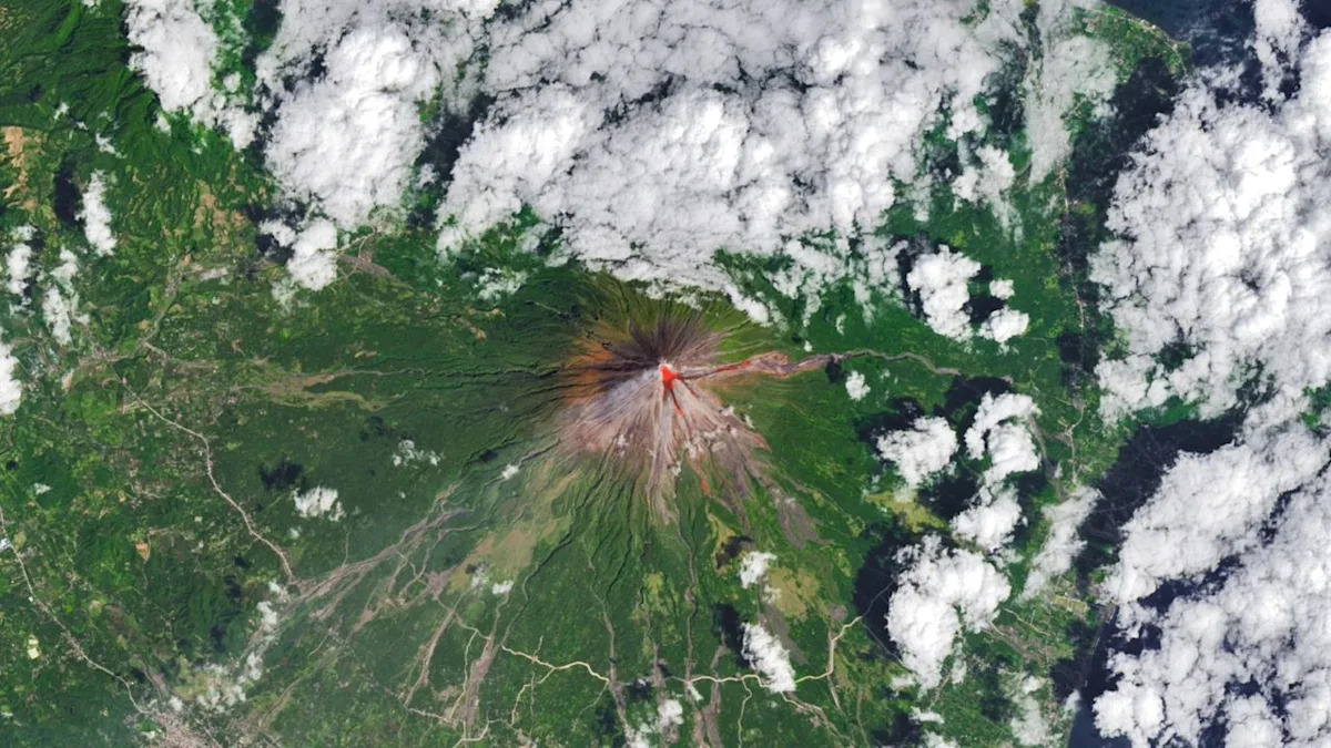
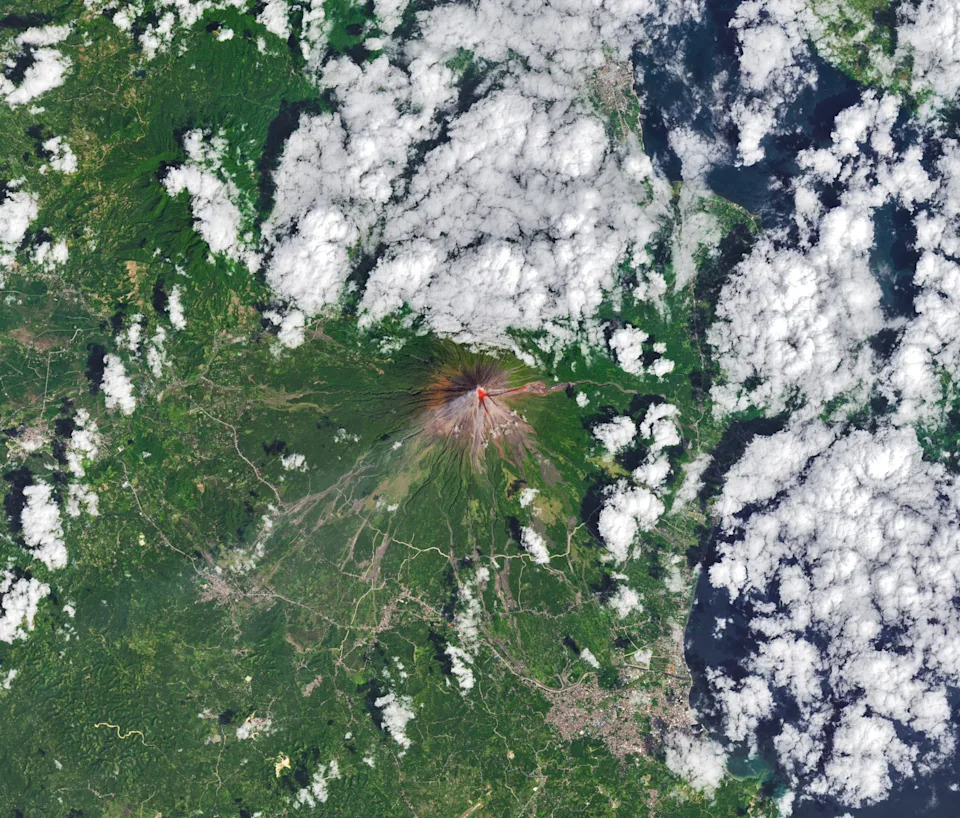
When you buy through links on our articles, Future and its syndication partners may earn a commission.

A new satellite image has captured a rare view of an erupting volcano, revealing its bright red lava flow as seen from space.

This image taken by NASA's Landsat 8 satellite captures lava, ash, and gases flowing from Mayon, the most active volcano in the Philippines, on Feb. 26, 2026. Mayon is found on Luzon, the nation's largest island, and rises over 8,000 feet (2,400 meters) above sea level.

Mayon began erupting in January 2026 when clouds of hot ash and flows of lava began pouring from the volcano's crater. The eruption has displaced hundreds of families in surrounding areas, according to NASA.

Previous eruptions have caused massive damage and fatalities. An eruption in 1993 killed at least 77 people, according to the Smithsonian Institution's Global Volcanism Program.

This image is a rare natural color glimpse into the eye of a volcano mid-eruption.

Bright red lava flows stand out starkly against the vivid green vegetation of the surrounding landscape, made more vibrant by combining visible light observations with infrared imagery.

The Operational Land Imager (OLI) instrument on Landsat 8 can capture light in both visible and near-infrared bands, enabling it to reveal features and events on Earth's surface that would otherwise be difficult to see from ground level.