yahoo Press
Strongest El Niño in 140 years? This one could actually deliver for California
Images

1 / 11

2 / 11

3 / 11

4 / 11

5 / 11

6 / 11
7 / 11
8 / 11

9 / 11

10 / 11

11 / 11
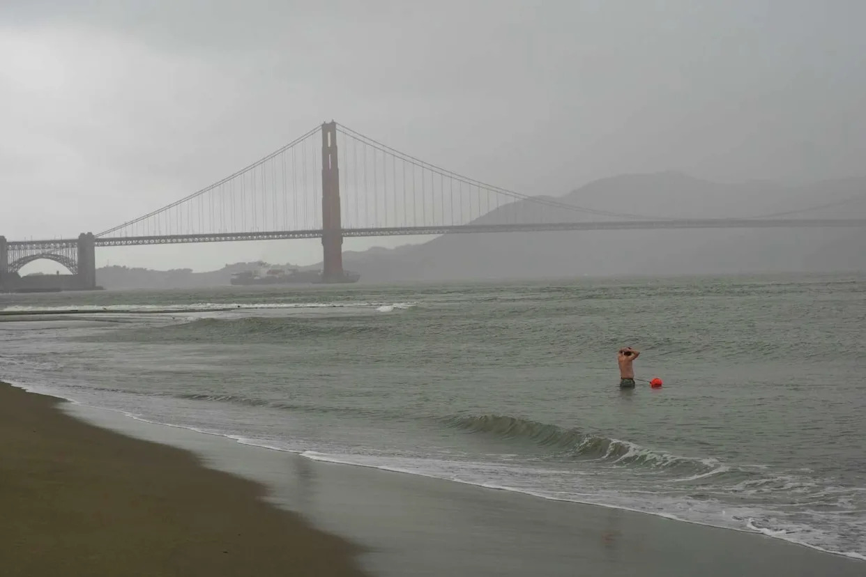
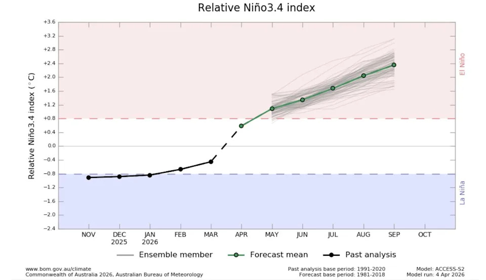
A rare cluster of three tropical cyclones will straddle both sides of the equator in the western Pacific this week, generating what one scientist called potentially the strongest westerly wind burst over the equatorial Pacific in the recent century. The burst is pushing warm water eastward at a critical moment, accelerating what Paul Roundy, an atmospheric scientist at the University at Albany, said has "real potential for the strongest El Niño event in 140 years." The just-released April seasonal forecast from the European Centre for Medium-Range Weather Forecasts shows virtually all of its models expect the world to reach El Niño conditions by mid-June. Roughly half project sea surface temperature anomalies exceeding 2.5 degrees Celsius above average by October. A strong El Niño would likely significantly reshape global weather patterns, potentially pushing global temperatures to record levels in 2027. The tropical cyclones are just the latest evidence of an emerging, potentially record El Niño. Their combined circulation is fueling the westerly wind burst now pushing warm water eastward across the Pacific. That burst "is located west of the warmest water presently in the Pacific Ocean, so it is ideally placed to drive that warm water eastward to form a strong El Niño event," Roundy said. He estimated the setup could cause El Niño to arrive quickly, within one to two months. This is the latest in a series of powerful westerly wind bursts that have swept the equatorial Pacific since January, bringing an end to a La Niña pattern and spreading unusually warm water across the Pacific, both at the surface and deep below it. Each successive burst has pushed that warm water further east, and this one, fueled by the rare triple cyclone pattern, may be the strongest yet. "What's different this year is the level of agreement across multiple models, not just one," said Muhammad Azhar Ehsan, a climate scientist at Columbia University's International Research Institute for Climate and Society. Forecasters from Australia and NASA, in addition to Europe, "are all signaling a strong El Niño," he noted. The next official forecast from his research institute, due April 19, is expected to trend stronger than last month's outlook, Ehsan said. The National Oceanic and Atmospheric Administration is scheduled to release its updated projections on El Niño on Thursday. While El Niño is often thought to bring more rain to California, residents have reason to take the news with a dose of uncertainty. In 2015, forecasters warned that a "Godzilla El Niño" would emerge, fueling hopes it would end a devastating multi-year drought that had left reservoirs depleted and communities on water rationing. The strong El Niño arrived, but drought-breaking rains did not. The Bay Area finished the winter with roughly average precipitation, while Southern California actually came in below normal at just 72 percent. It was a reminder that not all El Niño events play out as expected. Roundy said the developing event is following an evolution "actually similar to 1997," when warming originated in the eastern tropical Pacific near the South American coast. That's the pattern associated with the strong El Niño events that translated to above normal precipitation in California. In the El Niño years of 1982-83, storms destroyed 33 oceanfront homes, damaged thousands more and caused hundreds of millions in damage across 46 disaster-declared counties. The 1997-98 El Niño winter brought double the normal rainfall to much of the state, causing 17 storm-related deaths and roughly $850 million in damage. The 2015-16 event, by contrast, developed first in the central Pacific, a pattern that, as Roundy explained, "supported heavy rainfall off the coast of California instead of in California." Daniel Cayan, a climate researcher at the Scripps Institution of Oceanography who has studied California's hydroclimate for decades, said he sees reason for cautious optimism in regards to water resources in California and the Western U.S. over the next year. "I'm bullish on a strong El Niño," Cayan said. "It looks promising as far as a pretty strong event that would likely persist into and probably through the winter of 26-27." If the eastern tropical Pacific stays warm into winter, Cayan said, California would likely see a storm track pattern that typically steers Pacific storms directly into the state. "Hopefully that means the southwest, which has been extremely dry, will enjoy some renewed moisture, Cayan said. However, he added, ‘It's still early.' Cayan tempered his outlook with caution. "This is all couched in caution from being bruised and battered from previous (experiences)," he said. Roundy struck a similar note. While the event is beginning more like 1997 than 2015, he said, "I can't rule out the chance that (sea surface temperature) patterns during the California wet season end up looking like 2015." One signal to watch is temperatures this summer and fall. Cayan noted that during previous strong east Pacific El Niño events, temperatures across the West actually ran cooler than average from summer into winter. If that pattern begins to emerge this summer, it could be a sign that the event may be tracking the 1997 playbook. But Cayan cautioned that every event has its own characteristics, and that today's much warmer ocean baseline means historical patterns may not repeat cleanly. By midsummer, the picture should be substantially clearer. For now, the ingredients for a historic event are in place. This article originally published at Strongest El Niño in 140 years? This one could actually deliver for California.