yahoo Press
Minnesota snow totals so far for March 14-15 winter storm
Images

1 / 11
2 / 11

3 / 11

4 / 11

5 / 11

6 / 11
7 / 11
8 / 11

9 / 11

10 / 11

11 / 11
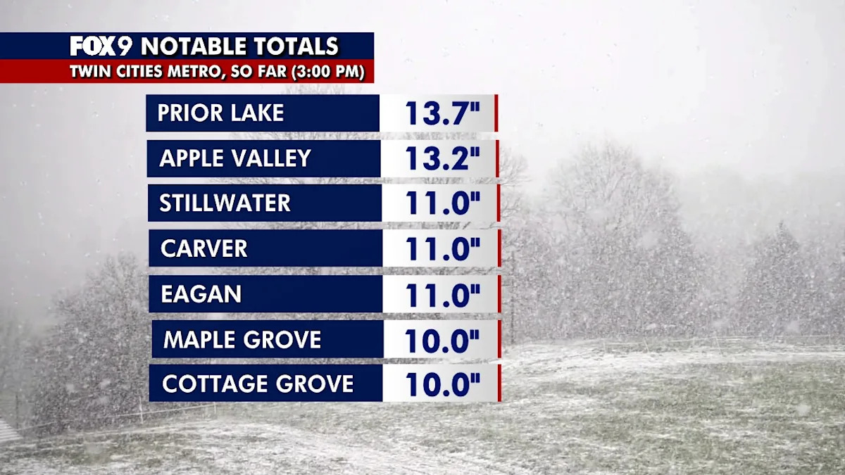
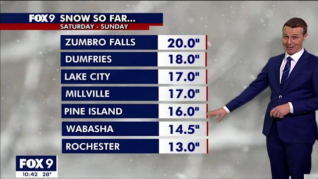
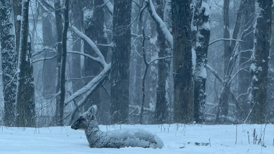
The Brief

Heavy snow continues to fall across much of Minnesota Sunday, with some places picking up more than a foot of snow.

Snow continues to fall Sunday.

Find live updates on Minnesota and Wisconsin snow totals below.

MINNEAPOLIS (FOX 9) - Snow is continuing to fall across much of Minnesota on Sunday. Here's a look at how much snow has fallen so far.

LIVE UPDATES: Minnesota winter storm

By the numbers

Here's a look at snowfall reports so far, as of early Sunday. This list will be updated throughout the day as more reports come in, and as snow moves out of the region.

Reads Landing, 20.5 inches

Zumbro Falls, 20 inches

Nelson, Wisconsin: 20 inches

Pepin, Wisconsin: 19 inches

Dumfries, 18 inches

Lake City, 17 inches

Millville, 17 inches

Pine Island, 16 inches

Wabasha: 15 inches

Oronoco: 14 inches

Prior Lake: 13.7 inches

Apple Valley: 13.2 inches

Eau Claire: 12.5 inches

Red Wing: 11 inches

Stillwater: 11 inches

Carver: 11 inches

Eagan: 11 inches

Maple Grove: 10 inches

Cottage Grove: 10 inches

Savage: 9.5 inches

Chanhassen: 9.4 inches

Elko New Market: 9.5 inches

Waseca: 9.5 inches

Owatonna: 9 inches

Lonsdale: 8 inches

Hastings: 7.8 inches

Chanhassen: 7.6 inches

Faribault: 7.5 inches

MSP Airport: 8.5 inches

Shakopee: 6.3 inches

White Bear Lake: 5.5 inches

Coon Rapids: 5.5 inches

St. Cloud: 4 inches

This story will be updated.

The forecast

A blizzard warning remains in effect Sunday, as snow continues to fall across much of Minnesota.

Heavy snow has developed across southern Minnesota and is expected to expand into western Wisconsin Sunday morning. Winds are expected to increase, with widespread blowing snow and blizzard conditions Sunday afternoon and Sunday night. Snowfall rates of 2–3 inches per hour are possible through mid-morning. Snow is expected to taper off from northwest to southeast Sunday afternoon and evening.